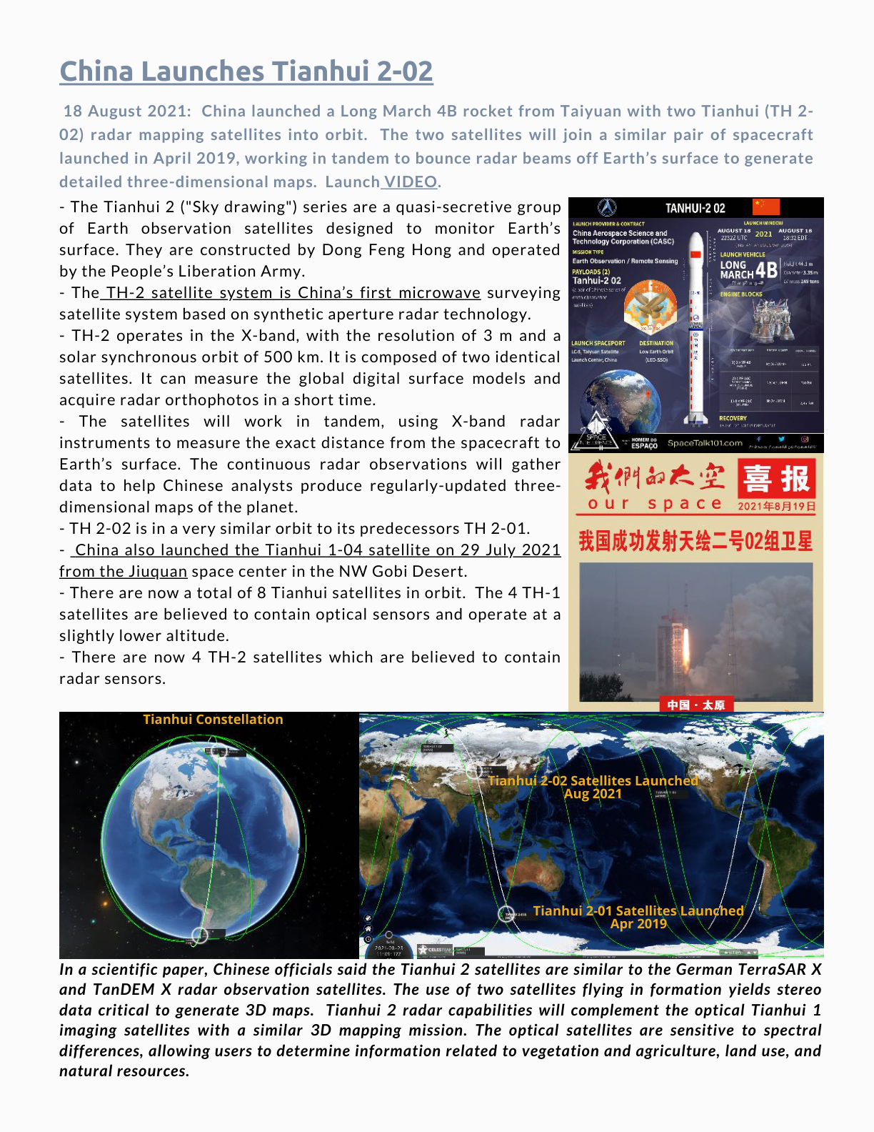
18 August 2021: China launched a Long March 4B rocket from Taiyuan with two Tianhui (TH 2-02) radar mapping satellites into orbit. The two satellites will join a similar pair of spacecraft launched in April 2019, working in tandem to bounce radar beams off Earth’s surface to generate detailed three-dimensional maps. Launch VIDEO.
– The Tianhui 2 (“Sky drawing”) series are a quasi-secretive group of Earth observation satellites designed to monitor Earth’s surface. They are constructed by Dong Feng Hong and operated by the People’s Liberation Army.
– The TH-2 satellite system is China’s first microwave surveying satellite system based on synthetic aperture radar technology.
– TH-2 operates in the X-band, with the resolution of 3 m and a solar synchronous orbit of 500 km. It is composed of two identical satellites. It can measure the global digital surface models and acquire radar orthophotos in a short time.
– The satellites will work in tandem, using X-band radar instruments to measure the exact distance from the spacecraft to Earth’s surface. The continuous radar observations will gather data to help Chinese analysts produce regularly-updated three-dimensional maps of the planet.
– TH 2-02 is in a very similar orbit to its predecessors TH 2-01.
– China also launched the Tianhui 1-04 satellite on 29 July 2021 from the Jiuquan space center in the NW Gobi Desert.
– There are now a total of 8 Tianhui satellites in orbit. The 4 TH-1 satellites are believed to contain optical sensors and operate at a slightly lower altitude.
– There are now 4 TH-2 satellites which are believed to contain radar sensors.
In a scientific paper, Chinese officials said the Tianhui 2 satellites are similar to the German TerraSAR X and TanDEM X radar observation satellites. The use of two satellites flying in formation yields stereo data critical to generate 3D maps. Tianhui 2 radar capabilities will complement the optical Tianhui 1 imaging satellites with a similar 3D mapping mission. The optical satellites are sensitive to spectral differences, allowing users to determine information related to vegetation and agriculture, land use, and natural resources.
Original PDF links: Source 1 · Source 2 · Source 3 · Source 4 · Source 5 · Source 6