Issue 130

China: Yaogan-45 Update

27 Sep 2025: As predicted in the previous Flash , China circularized Yaogan (YG)-45's (65563) and the satellite is now orbiting Earth at an average altitude of 7,500km. This is China’s first Yaogan satellite in Medium Earth Orbit (defined as 2,000 Inner Van Allen radiation belt. The inner Van Allen belt typically…

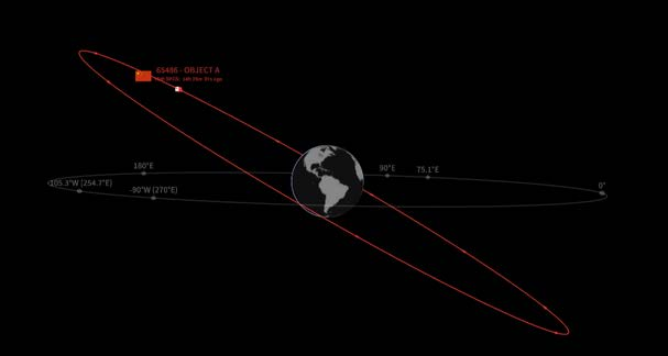
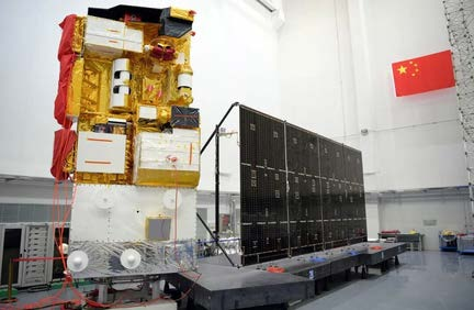
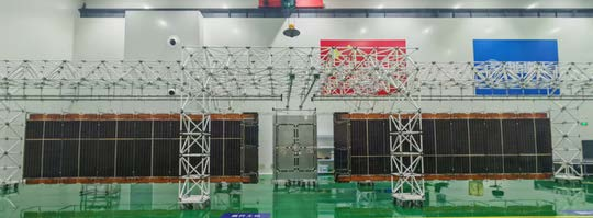
27 Sep 2025: As predicted in the previous Flash, China circularized Yaogan (YG)-45’s (65563) and the satellite is now orbiting Earth at an average altitude of 7,500km. This is China’s first Yaogan satellite in Medium Earth Orbit (defined as 2,000<MEO<35,786km). Traditionally, MEO is used for PNT missions such as GPS or Beidou. There are also communications satellites in this orbital regime, SES operastes 29 O3b satellites at ~8,050km and China has two Smart SkyNet (59705/59706) at ~20,000km. China has placed YG-45 in an inhospitable environment. At an average altitude of ~7,500km the satellite is right in the middle of the Inner Van Allen radiation belt. The inner Van Allen belt typically extends from an altitude of 600 to 1,000km to approximately 10,000 to 12,000km above Earth’s surface. This belt consists of electrons with energies up to 10 MeV and protons with energies up to ∼700 MeV (compare with estimated values at 500km of 0.04 MeV and 0.1 MeV respectively). At this challenging operational location YG-45 will be consistently exposed to high-energy particles that can damage the antenna’s materials and electronics, shorten its lifespan, and cause signal interference. With proper shielding it is possible to operate satellites for extended periods of time. The aforementioned O3b satellites were first launched in 2013 and are still listed as active in the space catalog. China’s intent to operate YG-45 at 7,500km helps to explain the need for an improved LM-7A capable of lifting 8,000+kg to orbit. Then there is YG-45’s 20° inclination. At this inclination, YG-45 will never overfly the island of Taiwan as it will only get as close to ~200km to the southern tip of the island (Taipei is about 1,000km north). This inclination is well suited for monitoring the South China Sea, Guam and Hawaii (see graphic). Chinese official sources noted YG-45 “will be mainly used for scientific experiments, land resource surveys, crop yield estimates, and disaster prevention and relief work”. This mission description matches those provided by other Yaogan satellites with Earth observation (imagery) missions. China has several imaging satellites in GEO (GF-4, GF-13 01, GF-13 02, YG-41 and LudiTance-4 01) so it is very likely they could successfully operate and imaging satellite in MEO. What I don’t know is if it would be possible to operate a SAR imager in the Van Allen belt environment or if the the highly charged environment makes that a practical impossibility. One thing I am certain of is operating an imaging satellite at 7,500km provides a large potential field of view. At this altitude the diameter of YG-45’s maximum field of view (the area of Earth visible from the satellite) of approximately 14,888km. The total area covered would be about 174 million square kilometers, or roughly 34% of the Earth’s surface. By comparison a satellite operating at 600km would have a maximum field of view of 4,800 km in diameter and a potential coverage area of 18 million square kilometers (~10%.) Absent an image from the first few days of YG-45’s time on orbit when it was in a highly elliptical 200km x 7,500km orbit, attempting to characterize YG-45 will be challenging. Non-earth imaging capable satellites orbit at altitudes of <600km, nearly 7,000km away from YG-45 making high resolution imaging an impossibility.

The Earth’s Inner Van Allen belts begin at about 600 km and extend to about 12,000 km; at 7,500 km, YG-45 is operating in the heart of this environment (www.sciencedirect.com).

Comparison of the 0°-inclined O3b constellation and YG-45 at 20° inclination (spaceaware.io).

YG-45 global ground track (saberastro.com).

YG-45 ground track over the Western Pacific (saberastro.com).

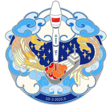
YG-45 mission patch, which suggests a side-looking SAR mission (nasaspaceflight.com).

Passive and active SAR antenna concepts discussed in relation to operating within the Inner Van Allen Belt (nasaspaceflight.com & www.janss.kr).