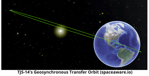
23 Jan 2025: China launched a Long March-3B rocket with the TJS-14 (62804) satellite from Xichang. According to official sources, the satellite has entered the planned orbit and will be used for satellite communications, radio and television, data transmission, other services and tests of related technologies. As of 1 Feb, the 18 SDS had cataloged TJS-14 in Geosynchronous Transfer Orbit (GTO). More to follow on this satellite once it settles into its GEO position. Launch Video. Bonus coverage of terrified civilians “observing” a spent stage from a Long March 3B hypergolic rocket falling in Zhenyuan County, Guizhou China (sound on).
– TJS-14’s inclination (28.5°) is indicative of a satellite heading to GEO. Recall TJS-13 launched into a Highly Eliptical Orbit from Xichang on 8 Dec 2024. TJS-13’s initial inclination was 51.0°.
-From Andrew Jones:
- The TJS-14 satellite will be mainly used for satellite communications, radio and television, data transmission and other services, and to carry out related technical tests and verifications, according to Chinese state media reports. No images of the satellite were published.
- TJS satellites are believed by outside observers to fulfill a range of functions, perform technology tests and test out new tactics, techniques and procedures. These include electronic intelligence (ELINT), technology related to missile detection and possibly early warning systems, new sensors, possible inspector satellites and experiments on advanced communications or signals intelligence.
- The satellite series could support the People’s Liberation Army (PLA) activities and capabilities in space, provide critical infrastructure for missile defense systems, and enhance China’s capacity for space-based communications.