
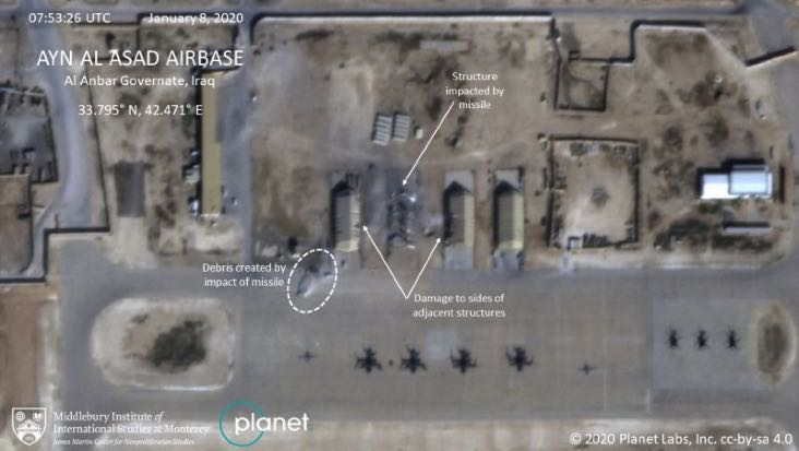
Iran used commercial satellite imagery to monitor Ain al-Asad Air Base before its January 2020 ballistic-missile attack, illustrating how commercial imagery can support operational planning.
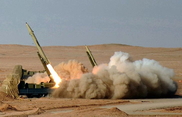
7 Jan 2020: Iran used commercial satellite images to monitor Ain al-Asad Air Base in Iraq as it prepared to launch more than a dozen ballistic missiles at U.S. and coalition forces. See VIDEO from 60 Minutes.
– The Iranian attack was “fierce revenge” for the assassination of Gen. Qassem Soleimani, killed by the U.S. in a drone strike days earlier. See VIDEO of air base attack.
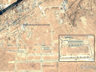
– Iran purchased satellite images of the base the day of the attack. USCENTCOM Commander Gen. Frank McKenzie timed the evacuation of al-Asad Air Base around Iran’s purchase of satellite imagery of the base.
– It is not clear which imagery provider Iran purchased the images from to support the attack.
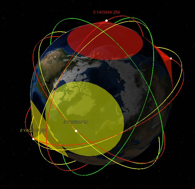
China launched a third Yaogan-31 triplet on 23 February 2021, adding to a constellation assessed by Western analysts as a military maritime-reconnaissance and ISR system.
23 Feb 21: China launched a third group of Yaogan-31 triplets from Jiuquan Satellite Launch Center in the Gobi Desert.
– The Yaogan 31G, 31H and 31J satellites are in similar orbits as the previous two groups, launched in April 2018 and January 2021, of around 1,100 by 1,050 km inclined by 63.4°.
– Western defense analysis suggests that Yaogan (“remote sensing”) satellites are military reconnaissance satellites and part of ISR systems for the PLA.
– The constellation has coverage gaps, missing one plane to have regular spacing, so there will very likely be a Yaogan 31-04.
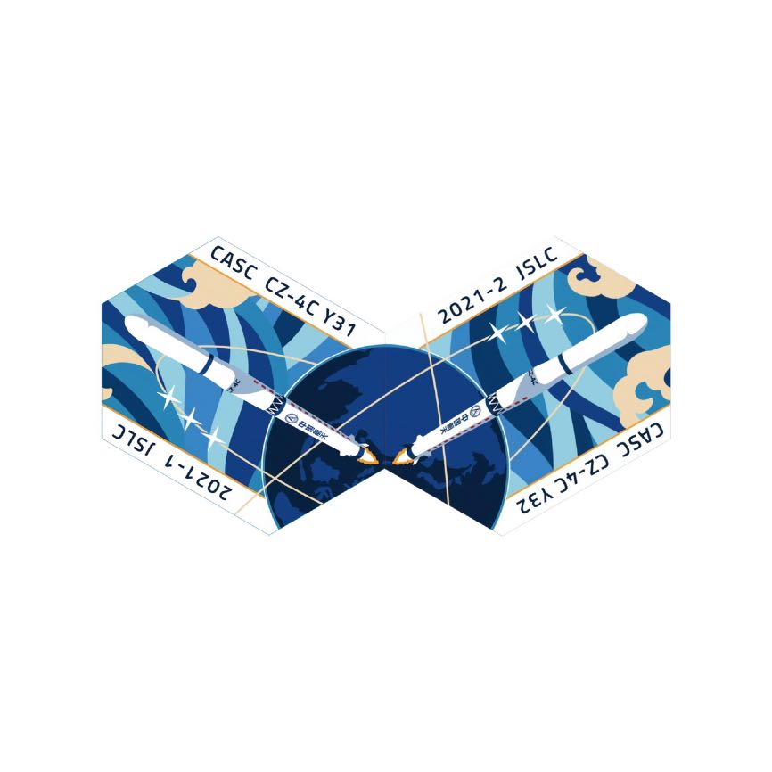
– The mission patches for the past two missions hint that another trio may be launched soon.
Yaogan satellites are believed to be equipped variously with optical, synthetic aperture radar and electronic intelligence payloads. The Yaogan-31 satellites and their orbits may be analogous to U.S. Department of Defense Naval Ocean Surveillance System (NOSS) satellite triplets.
China announced development work on two super-heavy lunar launch vehicles, including Long March 9 and a separate launcher based on existing five-meter cores and uprated YF-100 engines.
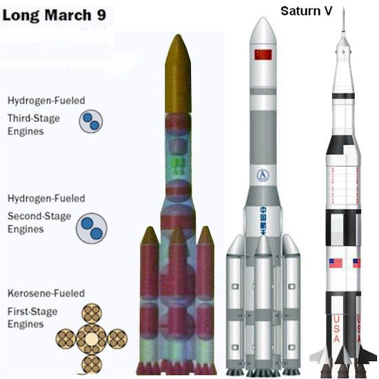
3 Mar 21: China announced it will work on development of two types of super-heavy launch vehicles for future lunar projects. See CCTV interview with LM-9 animation.
– The Long March 9 is designed to lift 140 tons to Low Earth orbit or 50 tons to trans-lunar injection and features four five-meter-diameter side boosters. The first test flight is expected in 2030.
– A separate, unnamed launcher is under development and expected to be based on existing 5-meter-diameter cores of the Long March 5, China’s largest launch vehicle, and up-rated versions of its YF-100 Keralox engines. However, there are challenges to combining components & technologies into a three-core launcher.
– “The successful development of these two types of rockets will greatly enhance the ability of the country’s spacecraft to enter outer space”—Jiang Jie, chief designer of the Long March 3A series.
China’s National People’s Conference is currently in session and expected to pass a final version of China’s 14th five-year plan covering 2021-2025 on 10 March. The new plan should provide new insight into China’s longer-term space priorities and objectives, with a new “space white paper” to follow later in the year.

The United States and allies were drafting language supporting international rules of behavior in space, with momentum building around norms intended to make the domain safer and more sustainable.
– Maj. Gen. DeAnna Burt, commander of U.S. Space Command’s combined force space component at Vandenberg AFB, CA, said international momentum is building for the adoption of a binding set of rules to make space safer and sustainable.
– Defense and State Department officials are drafting language on the U.S. position on a resolution approved in December by the United Nations General Assembly which calls for standardized and recognized “norms, rules and principles of responsible behaviors” in space.
– “The U.K. has stepped up,” Burt said. The United States is working with the U.K. and with a broader coalition that includes Canada, France, Germany, Australia and New Zealand.
– The UN has asked countries to submit input by May 3 for inclusion in a report to be reviewed by the UN General Assembly this summer.

President Biden released Interim National Security Strategic Guidance on 3 March 2021, including commitments to safe and secure space activities and shared norms with allies.
3 Mar 21: President Biden released his administration’s Interim National Security Strategic Guidance to set the conditions early in his tenure.
– “We will lead in promoting shared norms and forge new agreements on emerging technologies, space, cyber space, health and biological threats, climate and the environment, and human rights. And we will convene a global Summit for Democracy to ensure broad cooperation among allies and partners on the interests and values we hold most dear.”

A study of Russia’s optical reconnaissance systems examines aging Persona satellites, the planned Razdan replacement, and smaller EMKA/Razbeg-class imagery spacecraft.
Geek Out! A Study of Russian Optical Systems
Russia currently has only two operational Persona optical reconnaissance satellites in orbit, both of which may already have exceeded their design lifetime.
– 3 Persona satellites were launched, the first failed shortly after arriving on orbit. Operational Persona include Kosmos-2486 (2013) and Kosmos-2506 (2015). (VIDEO)
– The Kosmos-2486 and -2506 orbits are synchronized to provide maximum coverage of areas of interest on Earth. Despite the trouble-plagued start of both missions, the satellites appear to be operating normally ever since.
However, if their design lifetime is five years, both have exceeded it by now.
– The Persona satellites operate in conjunction with two military data relay satellites named Garpun (“Harpoon”). They were launched in Sep 2011 and Dec 2015 after many years of delays (the project was initiated in 1993). The second satellite is known to have been used for laser communication experiments with the third Persona satellite using an on-board laser terminal called LT-150. Only two of the Garpun satellites were manufactured and their design lifetime is unknown. A constellation of at least three satellites is required for full-time coverage.
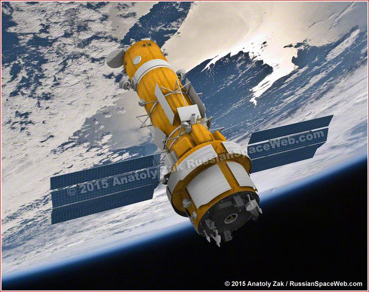
– The Persona will be replaced by more capable Razdan satellites carrying a primary mirror roughly the same size as those believed to be aboard US reconnaissance satellites (estimated to be 2.4 meters, capable of .15m resolution), but it is unclear when these will be ready to fly.
– Procurement documentation suggests two Razdan satellites are under construction. Documentation released in September 2017 pointed to possible launch dates in late 2020 and late 2021, but these dates are likely to have slipped since then.
– An experimental satellite launched in 2018 is likely the precursor of a constellation of smaller satellites to augment imagery provided by the big satellites.
– On March 29, 2018, Russia launched a small military satellite (EMKA), Kosmos-2525, from Plesetsk. It was placed into an orbit of roughly 320 by 350 KM with an inclination of 96.64°.
– EMKA is described as an “Experimental Small Satellite”, to serve as the basis for a “space-based Earth remote sensing complex.”
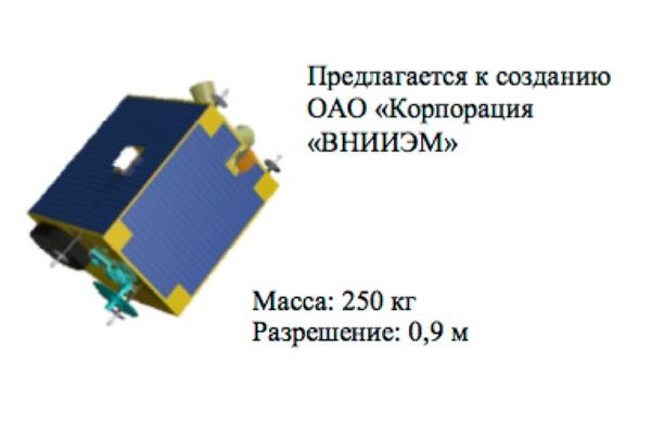
– EMKA may be comparable to the first in a series of American commercial Earth imaging satellites called SkySat-1 with a maximum resolution of 0.9 meters in panchromatic mode.
Russia is relying on two aging Persona satellites to provide high-resolution imagery in the interests of the Ministry of Defense. Both are functioning normally after overcoming significant problems during initial in-orbit testing. However, there is no guarantee they will continue to operate until the next-generation Razdan satellites are ready. This may be the reason for the development of a much smaller and simpler type of spy satellite (Razbeg) to help bridge the gap to Razdan and complement the imagery provided by the big satellites. The likely experimental precursor of these satellites (EMKA/Kosmos-2525) reached the launch pad just 2.5 years after being approved. The resolution offered by the smaller satellites will not match that of Razdan. The Ministry of Defense also operates two four-ton observation satellites called Bars-M (launched as Kosmos-2503 and 2515), but these are used for low-resolution cartographic imaging.

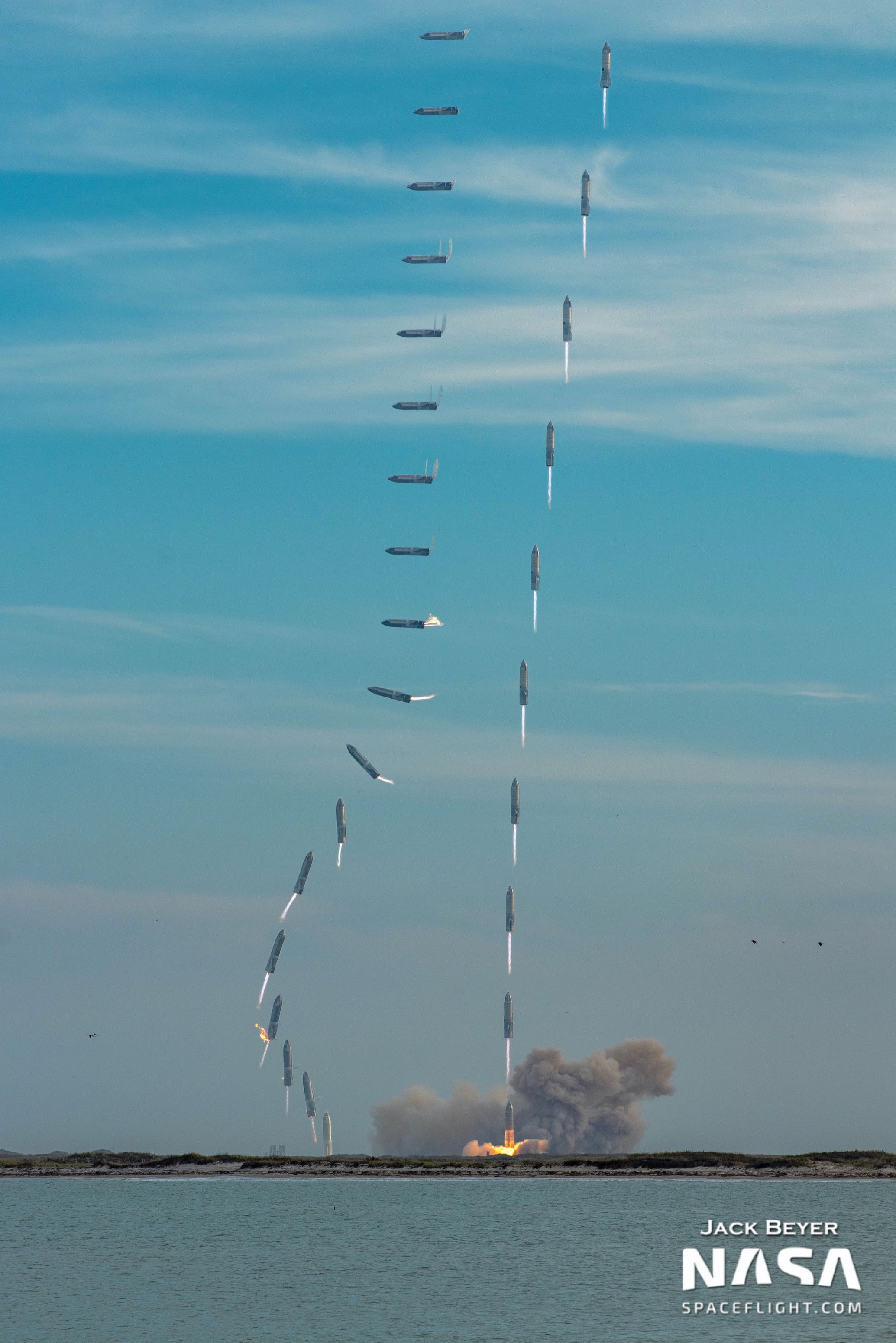
Stuck the Landing!
Fun Fact: the Soviet Fractional Orbital Bombardment System was designed to exploit gaps in U.S. early-warning radar coverage by approaching from unexpected directions.
Fun Fact: The Fractional Orbital Bombardment System (FOBS) was a Soviet innovation intended to exploit the limitations of US BMEW radar coverage. The idea behind FOBS was that a large thermonuclear warhead could be inserted into a steeply inclined low altitude polar orbit, such that it would approach the CONUS from any direction, but primarily from the southern hemisphere, and following a programmed braking manoeuvre, re-enter from a direction which was not covered by US BMEW radars.
The first warning the US would have of such a strike in progress would be the EMP transients produced by the nuclear devices initiating over their programmed targets in the CONUS. Eighteen silos at Baikonur were loaded with these weapons until 1983, when they were decommissioned under the terms of the SALT-2 treaty. Here is a MegaProjects VIDEO.
Space themes at China’s Lantern Festival featured Chang’e-5 and a Galactic Energy Ceres-1 launcher emerging from a bowl.
Space Themes abound at the Lantern Festival in China (15th day of the first lunar month), celebrated with yuanxiao/rice balls with various fillings. Here’s Chang’e-5 getting involved, & a Galactic Energy Ceres-1 launcher emerging from a bowl.


Flash Insider
Subscribe to unlock full access to this Issue and the complete Flash archive.
Subscribe Now Already Subscribed? Log In