
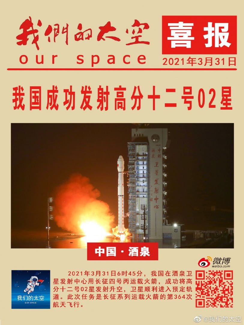

China launched Gaofen-12 (02) on 31 March 2021 into a sun-synchronous orbit, adding another likely SAR imaging satellite to the expanding Gaofen constellation.
31 Mar 2021: China launched the Gaofen-12 (02) (likely a SAR imagery satellite) on a Long March 4C from Jiuquan, northwest China. The country’s Gaofen constellation continues to grow at an impressive rate, having launched 8x Gaofen in 2020. See VIDEO.
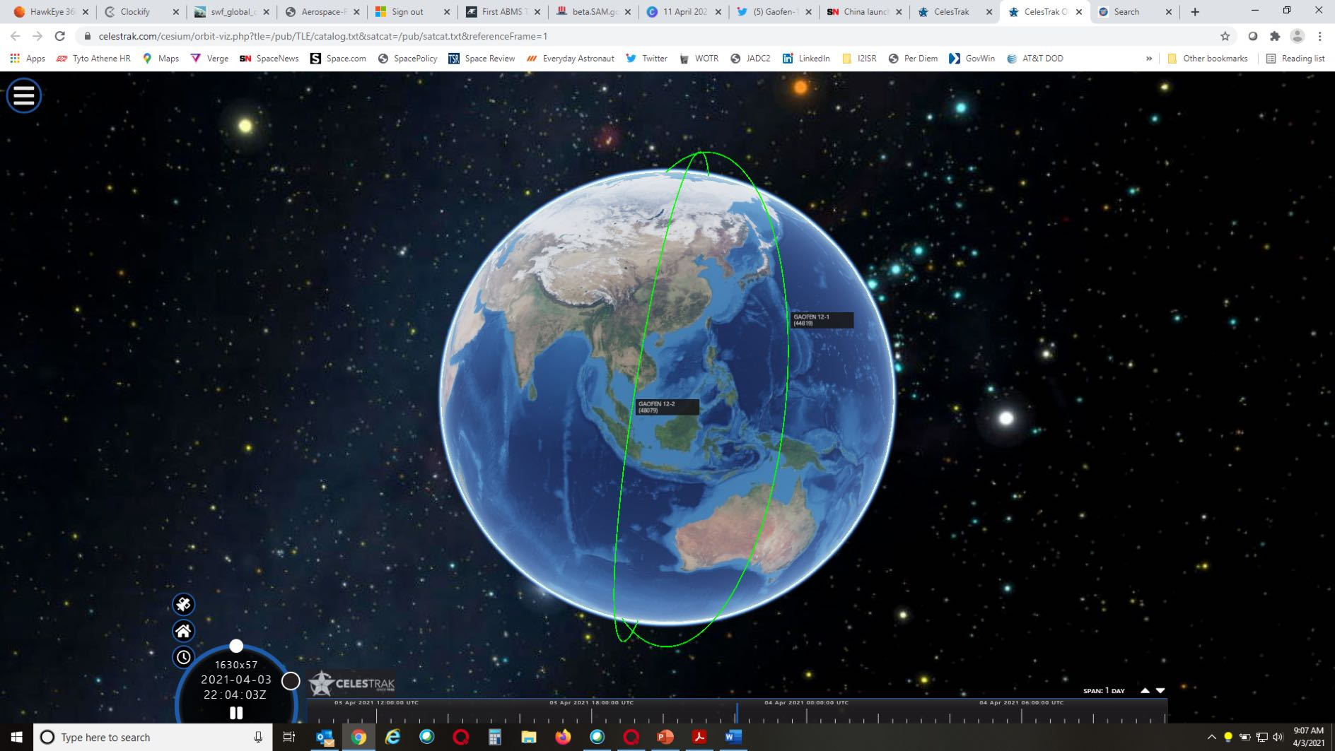
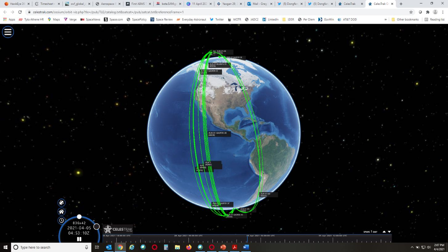
– The Gaofen-12 (02) satellite was sent into a 594 x 600 kilometer sun-synchronous orbit, according to U.S. satellite tracking. The first Gaofen-12 was launched into a similar initial orbit in December 2019. View orbit.
– The Gaofen-12 (02) satellite is nominally part of the civilian China High-resolution Earth Observation System (CHEOS). Chinese media state that the satellite will be used in land surveys, urban planning, road network design and crop yield estimation, as well as disaster relief.
– CHEOS was initiated in 2010 to provide all-weather/day coverage with synthetic aperture radar and EO satellites.
– Gaofen 12 and 12-2 are equipped with high-resolution capability via a microwave remote sensing system (SAR), with ground resolution estimated up to the sub-meter level. It is possibly a civilian version of the Yaogan 29 type satellite.
Resolution capabilities and other information has been published for lower numbered Gaofen series satellites. However information for Gaofen satellites numbered 8 and above has not been openly released, suggesting the satellites are for national defense purposes.
CGSTL announced plans to complete a 138-satellite Jilin-1 Earth-observation constellation during China’s 14th Five-Year Plan, with a target of 60 satellites on orbit in 2021.
11 Mar 21: Chinese EO company #CGSTL announced that they would complete their 138-satellite Earth observation constellation during the 14th Five-Year-Plan (2021-2025). This effort also includes reaching 60 satellites in orbit this year (there are currently 25 “Jilin-1” satellites on orbit).
– CGSTL (aka Charming Globe) is one of the most developed commercial Earth Observation (EO) companies in China, and is a spin-off from the Changchun Institute of Optics and Fine Mechanics.
– CGSTL raised $375M (US) in Nov. 2020, making it the best funded EO company worldwide.
– CGSTL has produced a variety of Chinese commercial satellites. Most have been <100kg but CGSTL also manufactured the high resolution KF-01 with a mass of 1.25 tons.
– In September 20, CGSTL launched 9 satellites from an ocean barge based LM-11. To reach their goal of 60 satellites on orbit by the end of 2021 they would need to conduct another 4 such launches. See Launch VIDEO.
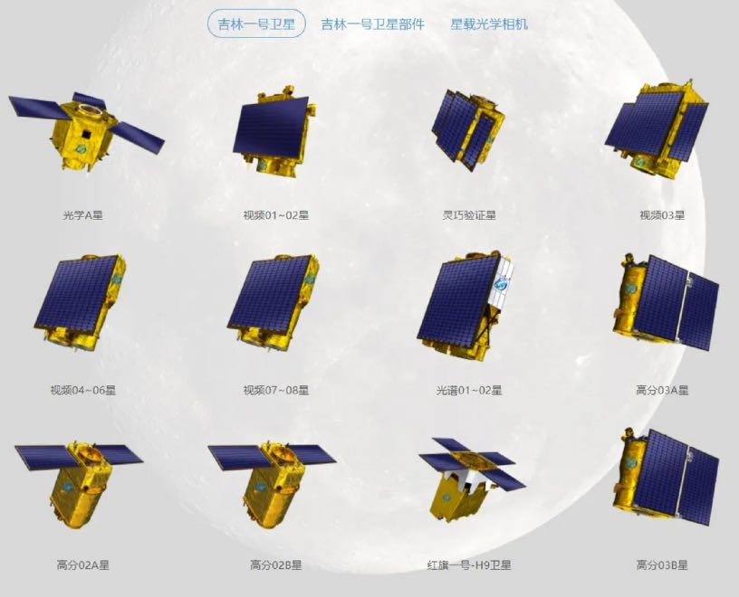
– The Jilin-1/Gaofen-03 (Jilin-1 High Resolution-03) satellites have a mass of less than 40 kg, and includes video satellites and push-broom imaging satellites. Their orbits range from 450-650km in altitude.
– The push-broom satellites are able to obtain images with panchromatic resolution better than 1 m, multi-spectral resolution better than 4 m, and with a swath width larger than 17 km. The video satellites can obtain color video images with a resolution better than 1.2 m and a coverage area not less than 14.4 km × 6 km.
– With funding secured and established manufacturing processes CGSTL has reached “batch production” capability.
CGSTL is China’s leading commercial earth observation company and is positioning itself to compete in the global market for earth sensing services. With increasing numbers of satellites on orbit CGSTL is able to reduce the time required to image any area of interest on the globe. The desired end-state is a constellation capable of capturing and transmitting an image anywhere on earth in 10 minutes or less.


China’s evolving space culture combines historical narratives, state-led ideology, commercial products and media to reinforce the idea of China as a major spacefaring power.
While not widely known or discussed outside of China, popular space culture has been growing parallel to the country’s space industry. Ideologies surrounding Chinese space exploration are being steadily cultivated by state actors, and commercial products and media related to China’s space program have exploded onto the domestic market.
– There are three key “spirits” or historical influences that make this emerging space culture quintessentially Chinese: the traditional spirit, the “two bombs one satellite” spirit, and the crewed space spirit.
– The traditional spirit refers to traditional Chinese civilization, the culture and values of which constitute the bedrock of contemporary China.
– The “two bombs one satellite” spirit refers to the late 1960s when China first achieved its successful atomic bomb and intercontinental ballistic missile tests, as well as the launch of its first artificial satellite. This period is considered to be the birth of the Chinese space program.
– The crewed spirit refers to China’s taikonaut program, particularly the launch of China’s first taikonaut in 2003, which cemented China as a member of the prestigious crewed spaceflight club alongside the United States and Russia.
– It’s now common to see Chinese brands partnering with the nation’s state-run space organizations to create a number of unique space-themed products “with Chinese characteristics.”
– Chinese sports company Anta teamed up with the country’s main space contractor China Aerospace Science and Technology Corporation (CASC) to release a line of Beidou-themed apparel.
– Media that places China at the forefront of space exploration has begun to trickle into the international consciousness, such as the translated “The Three Body Problem” book trilogy and “The Wandering Earth” film that is available to view on Netflix. Such products help to normalize the idea of China as a key actor in space.
Chinese products that incorporate its past serve to strengthen the narrative that China’s space program is also a natural continuation of its civilization – that China also belongs in space. While still in the early stages of international proliferation, we must anticipate the potential challenges that China’s space culture may pose to the United States’ long-standing supremacy on how the world perceives space exploration and leadership in space.


India planned to launch its first GEO imaging satellite, GISAT-1, in April 2021 to provide frequent near-real-time imagery of the Indian subcontinent and border areas.
26 March 2021: India announced plans to launch India’s first Geo Imaging Satellite (GISAT-1) during the first or second week of April.
– GISAT-1 was previously planned for launch on 5 March and then 28 March. Both dates were delayed due to minor technical issues.
– GISAT-1 will operate on an orbital slot around 93.5° East, colocated with Insat 3A, Insat 4B and GSat 15.
– The mission of GISAT-1 is to facilitate continuous observation of Indian sub-continent, quick monitoring of natural hazards and disaster.
– GISAT carries an imaging payload consisting of multi-spectral (visible, near infra-red and thermal), multi-resolution from 50 m to 1.5 km. It will provide pictures of the area of interest on near real time basis including border areas.
– The satellite was originally planned to be launched in 2017 or 2018. GISAT-1 details.
GISAT will provide near real time pictures of large areas of India, under cloud free conditions, at frequent intervals. That is, selected Sector-wise image every 5 minutes and entire Indian landmass image every 30 minutes at 50 m spatial resolution. Of particular interest to Indian authorities are the northern Indian borders. India, which has been involved in several border skirmishes with China, is aggressively building up its infrastructure to defend its territory. Employing this satellite will provide India with the capability to observe and preemptively position itself against Chinese troop movements on its border.
![GISAT 1 [ISRO].](https://integrityflash.isruniversity.com/wp-content/uploads/2026/08/issue-19-gisat1-spacecraft.png)
![GISAT 1 [ISRO] in Cleanroom.](https://integrityflash.isruniversity.com/wp-content/uploads/2026/08/issue-19-gisat1-cleanroom.png)

Preparing for Take-off... On Mars!
Preparing for Take-off… On Mars! The Issue 19 cover highlights the Mars helicopter preparing for flight.

Fun Fact: the 1859 Carrington Event caused telegraph failures, shocks, fires and extraordinary auroras after a powerful solar eruption.
Fun Fact: On 28 August 1859, a series of sunspots began to form on the surface of our stellar parent. The sunspots quickly tangled the Sun’s magnetic field lines in their area and produced bright, observed solar flares and one — likely two — Coronal Mass Ejections, one major. Upon impact, telegraph systems across Europe and North America, which took the brunt of the impact, failed. In some cases, telegraphs provided electric shocks to operators; in other cases, their lines sparked in populated areas and — in places — started fires. The event produced some of the brightest auroras ever recorded in history. People in New England were able to read the newspaper in the middle of the night without any additional light. Meanwhile, in Colorado, miners believed it was daybreak and began their morning routine. The strength of the Carrington Event is now recognized in heliophysics as a specific class of CME and is named after Richard Carrington.
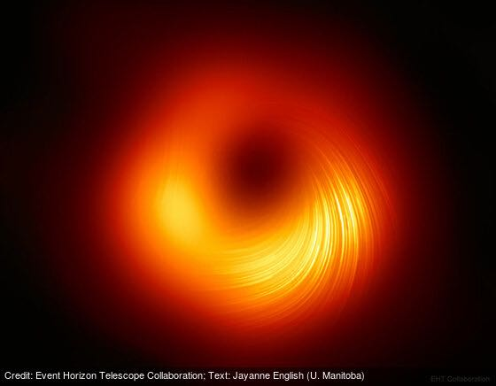
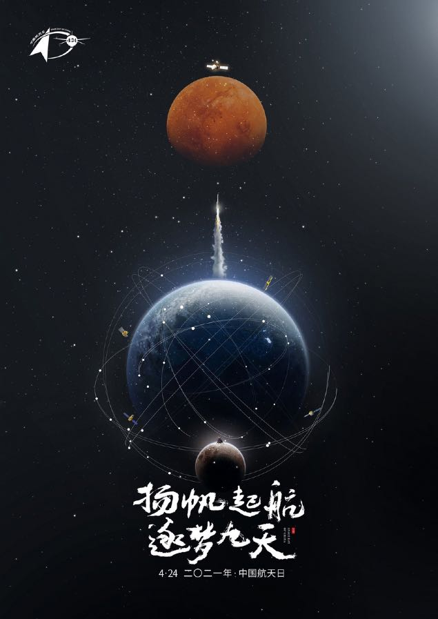
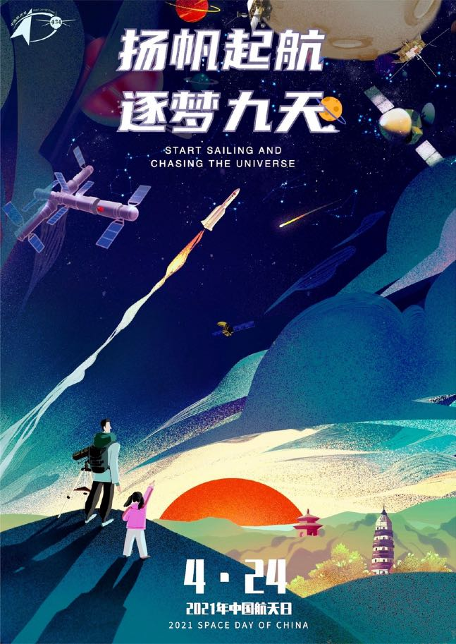
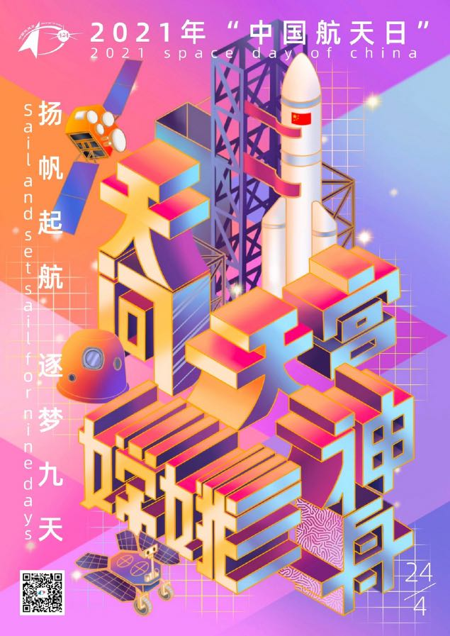
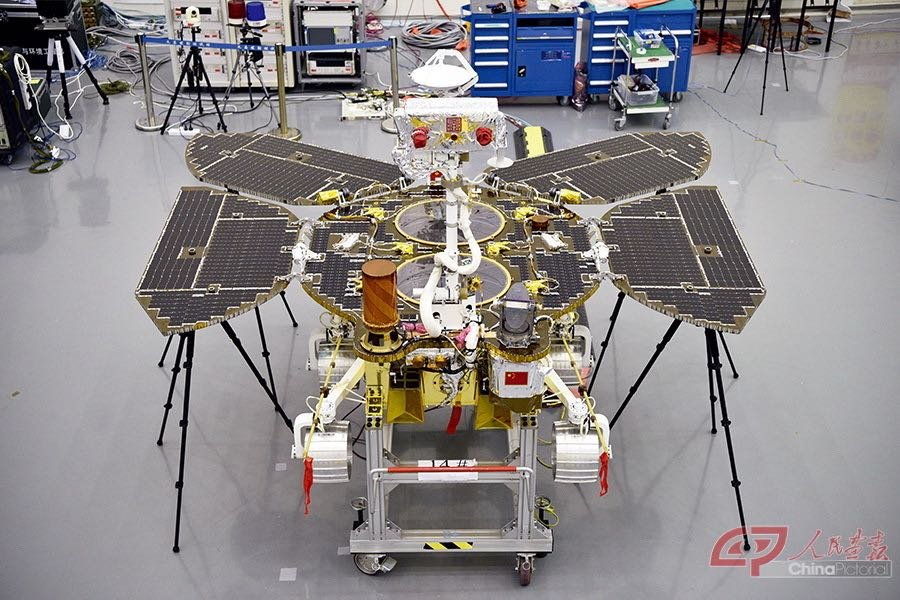
Pics o' the week: OneWeb’s 36-satellite launch, the Messier 87 black hole image, China Space Day poster artwork, and China’s Mars rover.
Event Horizon Telescope Image of Messier 87 Black Hole
Space artwork for the China Space Day Poster (Apr 24) Competition

Flash Insider
Subscribe to unlock full access to this Issue and the complete Flash archive.
Subscribe Now Already Subscribed? Log In