19 Feb 2022: Russian positioned its electronic warfare units along with other forces along the Ukrainian border. They include TORN and SB-636 Svet-KU signals-intelligence systems that can pinpoint Ukrainian units by tracing their radio signals, RB-341V Leer-3s that combine Orlan-10 drones carrying cellular-jamming payloads with a command post on a KamAZ-5350 truck, R-934B Sinitsa radio-jammers and R-330Zh Zhitels that block satellite links. Russia is also preparing its own forces to operate without GPS or GLONASS.
– Russia’s military doctrine assumes signals from space, including it’s own GLONASS and other GNSS, will not be available once a battle begins.
– There is little question that Russia will jam and/or spoof GPS receivers during an invasion of Ukraine, as going after GPS has become almost ubiquitous as a first military move since Kosovo.
– The terrestrial Chayka system, a version of Loran-C, is maintained to protect their homeland with navigation and timing services when signals from space are not available.
– The portable Skorpion system is designed for military use during expeditions to areas where Chayka or Loran is not available, according to western military analysts.
– “Three of Russia’s Chayka/Loran stations have Ukraine surrounded,” explained UrsaNav CEO Charles Schue, referring to a graphic he provided GPS World. “They provide ideal coverage and will allow navigation accuracy of between 20 and 50 meters over most of the Ukraine.
– Russia used cyber and electronic warfare methods to isolate Ukrainian forces in 2014.
– During that conflict Russian forces located with drones, isolated with electronic jammers then destroyed with artillery a powerful-on paper, at least-Ukrainian armored group.
– In addition to jamming communications and GPS, there is concern Russia could directly target US and other western intelligence, surveillance and reconnaissance (ISR) satellites, including commercial remote sensing birds.
– Russia has a host of non-kinetic options for targeting satellite systems that could be disruptive or destructive for American industry and its government customer.
– The Law of Armed Conflict (LOAC) clearly sets out that any satellites being used by Ukraine, no matter who owns those satellites, are lawful targets.
– Russia might feel more free to interfere with commercial remote sensing satellites than those operated by NRO and the Defense Department.
– Cyber protections used by commercial satellites may not be as robust as those used by the military or the Intelligence Community, making it both easier for Russian hackers to get in and harder to pin any shenanigans on them if they do.
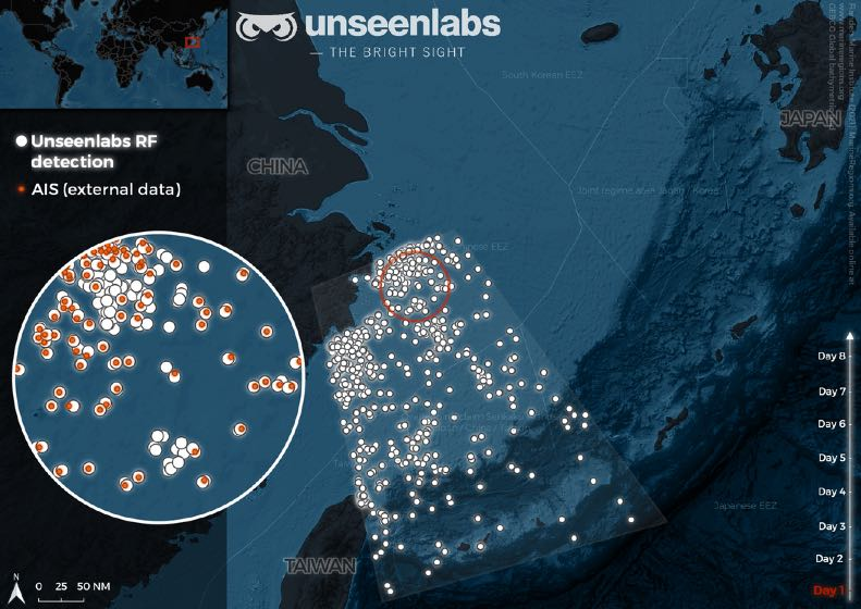
– Jamming and spoofing of GPS signals essentially has been tolerated by the Pentagon…That seems to indicate that similar actions against ISR satellites might also be accepted, especially if those satellites are commercial ones.
Expect, in wartime, for Russia to again jam Ukrainian battalions. Once the units no longer can communicate and find themselves blind and without orders, the Russian artillery will rain down.
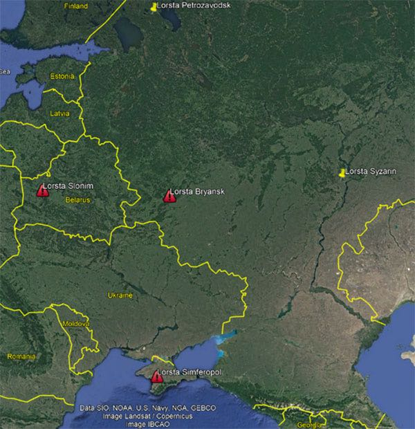
Russian Chayka Stations.
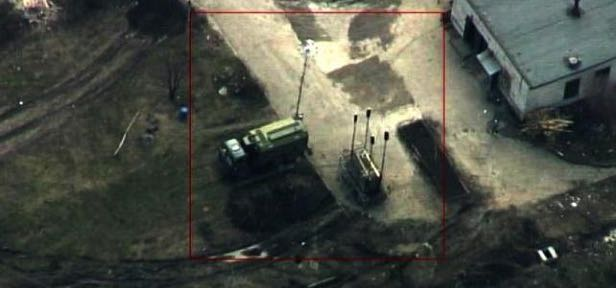
Russian EW in Donbas.