
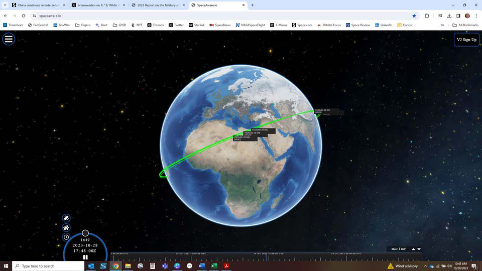
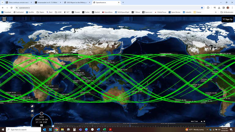


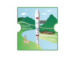
23 Oct 2023: China launched a Long March 2D from the Xichang Satellite Launch Center in southwest China carrying three satellites, Yaogan-39-04 A/B/C. This is the 14th satellite trio China has launched since 2022. YG-39-04 satellites are in the same orbit as previous YG-35, 36 and 39 satellites with an altitude of…
23 Oct 2023: China launched a Long March 2D from the Xichang Satellite Launch Center in southwest China carrying three satellites, Yaogan-39-04 A/B/C. This is the 14th satellite trio China has launched since 2022. YG-39-04 satellites are in the same orbit as previous YG-35, 36 and 39 satellites with an altitude of ~500km and 35° inclination. YG-39-05 is scheduled for launch on ~ 11 Nov 2023 and is believed to be the final piece to this new ISR constellation.
– Little is publicly known about the Yaogan satellites. State media outlet China Daily described the spacecraft as remote-sensing satellites tasked with observing, surveying and measuring objects on land or at sea, as well as monitoring weather.
– Western observers believe Yaogan satellites have partially military purposes. The wider series includes optical, radar and electronic intelligence gathering satellites.
-YG-39-04’s launch vehicle (LM-2D) and location (Xichang) matches all 13 previous YG-35, YG-36 & YG-39 launches.
– YG-39-04A/B/C are still conducting initial maneuvers and it is too early for analysts to assess formation.
– As with its predecessors, YG-39-04 satellites are co-planar with other YG-35 and YG-36 satellites. In this case YG-39-04 is co-planar with YG-35-05 and YG-36-03.
– All YG-35/36 and 39 satellites are co-planar with other satellites of this family.
-Here are all five orbits:
– Each group will pass over the same points above Earth at different times, providing more frequent coverage over areas of interest.
– More broadly, it appears that China is continuing to experiment with various spacing alternatives for the YG-35/36/39 satellites while also grappling with anomalies from at least two of the 39 satellites.
– Per the 2023 DoD Annual Report to Congress: China’s “… ISR systems, most of which could support monitoring, tracking, and targeting of U.S. and allied forces worldwide,
especially throughout the Indo-Pacific region. These satellites also allow the PLA to monitor potential regional flashpoints, including the Korean Peninsula, Taiwan, the Indian Ocean, and the South China Sea.”
-The orbits of the 42 YG-35/36/39 satellites appear to be optimized to perform such monitoring.
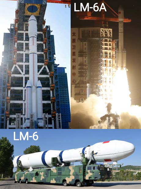
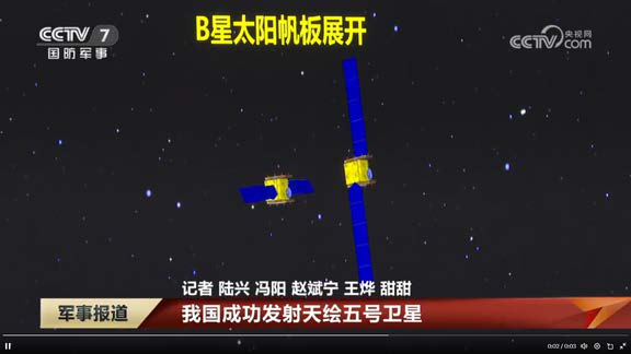
31 Oct 2023: China launched a modified LM-6A from Taiyuan Satellite Launch Center carrying the Tianhui-5A and 5B remote sensing satellites. According to official sources, the satellites entered their intended orbits and “will be used for geographic mapping, land resource survey, scientific experiments and other…
31 Oct 2023: China launched a modified LM-6A from Taiyuan Satellite Launch Center carrying the Tianhui-5A and 5B remote sensing satellites. According to official sources, the satellites entered their intended orbits and “will be used for geographic mapping, land resource survey, scientific experiments and other missions,” Launch Video.
– Tianhui translates to “sky-drawing” and is a series of unclassified cartography satellites operated by the China Aerospace Science and Technology Corporation (CAST).
-The Long March 6A has taller payload fairings, ~2 m taller than LM-6 Y1/2. This is the first time the LM-6A has been used to launch Tianhui satellites.
-The two Tianhui-5 mapping satellites are in a 606 x 607 km x 97.8° Sun-sync orbit.
-Tianhui-5A/B’s altitude is greater than all other Tianhui satellites with the exception of Tianhui-6A/B (launched in March 2023). Tianhui-6A/B are in an 888 × 880 km orbit with an inclination of 99°.
– Tianhui-5A/B orbit is similar to that of the Tianhui 6A & 6B pair, all four satellites will probably work together to produce 3D radar imaging
– The Tianhui constellation consists of 14 satellites. China has launched 11 since 2019.
– The four Tianhui-1 spacecraft operate independently, and are equipped with three separate Earth observation cameras: a panchromatic camera (5m), a panchromatic CCD camera (2m) and a multi-spectral imager (10m).
– Tianhui-2 satellites were China’s first microwave surveying satellite system based on synthetic aperture radar (SAR) technology. TH-2 satellites operate in the X-band, with a 3 m resolution. In May 2023, China maneuvered Tianhui 2-02A & 02B to within 1 km of one another.
– Tianhui 2-02A moved into proximity with 2-02B, after making multiple altitude changes, whereas the SMA for 2-02B remained unchanged.
– Tianhui-4A/B, 6A/B – and now 5A/B satellites (Tianhui-3 does not exist yet) – operate in formations of two, and are also likely SAR capable.
– Known Yaogan SAR satellites operate with apogees between 484 – 694 km, and Gaofen SAR satellites range 626 – 749 km. Commercial SAR imager Capella operates satellites between 399 – 491 km.
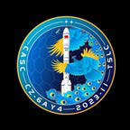
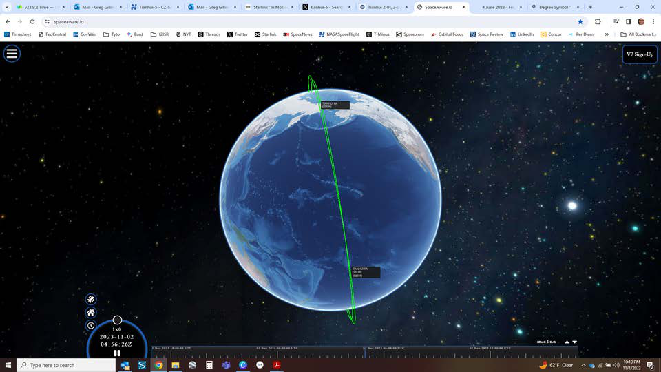
3 Nov 2023: China launched a Long March (LM)-7A from Wenchang Space Launch Site to Geostationary Orbit (GEO), carrying the Tongxin Jishu Shiyan Weixing (TJS)-10 satellite. TJS spacecraft are classified Chinese military satellites associated with Signals Intelligence (SIGINT), missile warning, and “satellite inspection”…
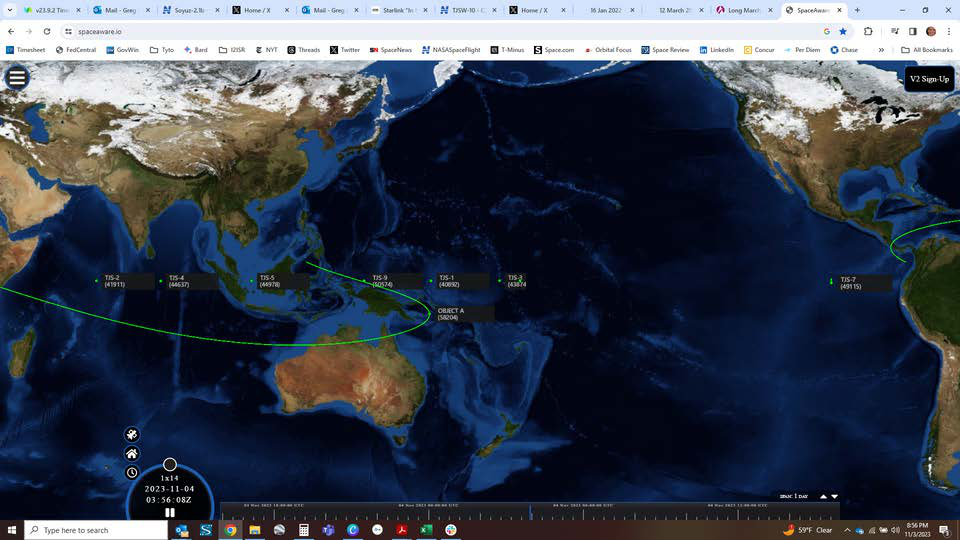
3 Nov 2023: China launched a Long March (LM)-7A from Wenchang Space Launch Site to Geostationary Orbit (GEO), carrying the Tongxin Jishu Shiyan Weixing (TJS)-10 satellite. TJS spacecraft are classified Chinese military satellites associated with Signals Intelligence (SIGINT), missile warning, and “satellite inspection” missions. Chinese state media only noted the spacecraft was a “communications technology experiment.” Launch Video.
– As of 3 Nov, TJS-10 was in Geostationary Transfer Orbit (GTO) and had not arrived at its GEO slot (which is unknown at this time).
– TJS-10 is the first TJS satellite to be launched by the LM-7A and the Wenchang launch facility. China launched all previous TJS satellites using the older LM-3B (one instance of a 3C), and all launches were from Xichang.
-The LM-7A is a three-stage rocket that is expected to eventually replace the LM-3B.
– LM-7A can lift 22% more mass to GTO (7,000 kg) as compared with the LM-3B/E (5,500 kg).
– China has used the LM-7A for several interesting GEO payloads including the SJ-23 and SY-12A & 12B satellites.
-The only Chinese booster capable of lifting more mass to GTO is the LM-5B.
– Most observers believe the TJS series of satellites actually serve the Chinese military, providing early warning and intelligence gathering functions.
– CAST built the TJS-1, 4 & 9, all of which are likely SIGINT satellites.
– Alternatively, analysts believe the SAST-built TJS-2, 5, 6 and 7 are part of China’s Huoyan
missile warning constellation.
– Identified as a GEO belt “inspector sat,” TJS-3 exhibited unusual behavior after launch, interacting with its apogee kick motor.
–TJS-7 is the only Chinese GEO satellite over the western hemisphere, parked at 99.6° west longitude. Its mission remains a mystery.
-TJS-10’s mission is also unknown.
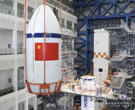
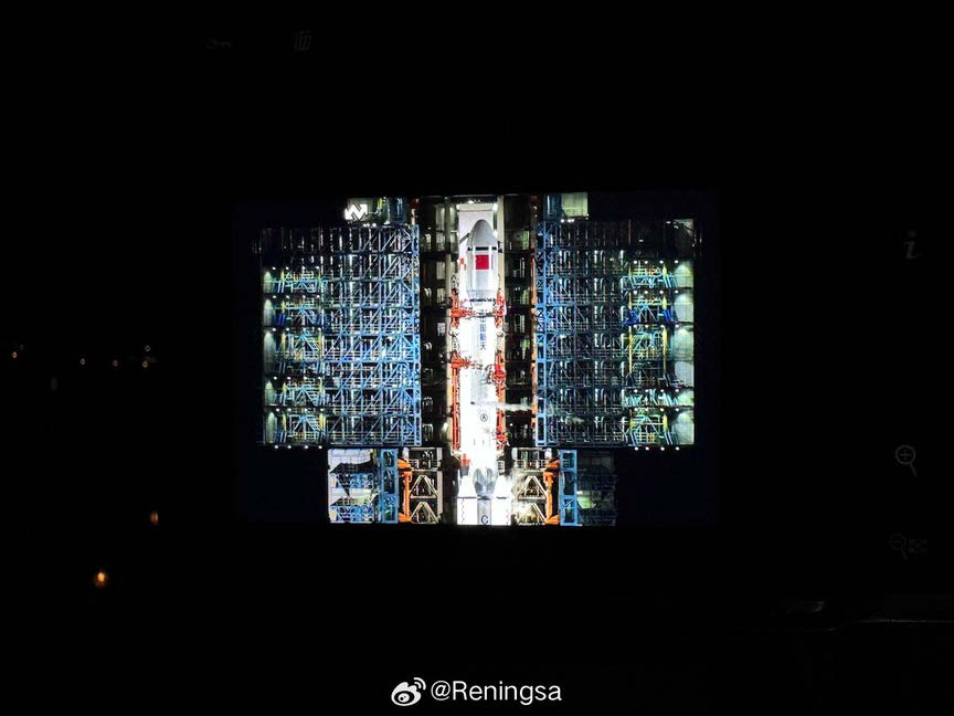
31 Oct 2023: A report published by the China Space Monitor alleges a Chinese company, Chang Guang Satellite Technology Co., Ltd. (CGSTL), sold two of its on-orbit Jilin-1 GF03D series satellites to the Russian paramilitary Wagner Group. These satellites are capable of collecting 0.75m full color imagery or 3m…
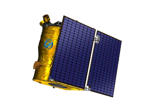
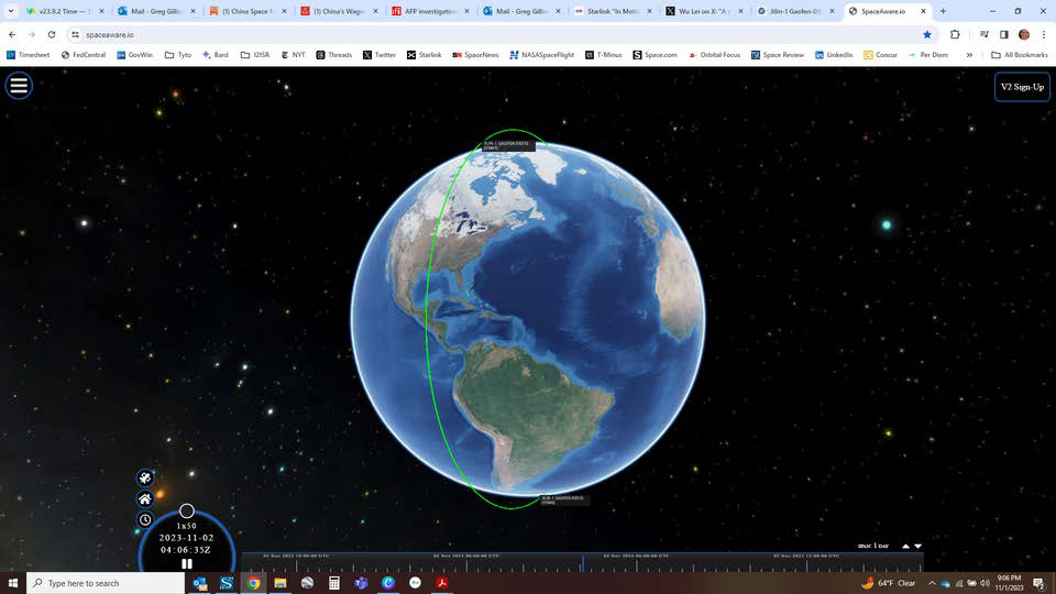
31 Oct 2023: A report published by the China Space Monitor alleges a Chinese company, Chang Guang Satellite Technology Co., Ltd. (CGSTL), sold two of its on-orbit Jilin-1 GF03D series satellites to the Russian paramilitary Wagner Group. These satellites are capable of collecting 0.75m full color imagery or 3m hyperspectral imagery. The transaction reportedly took place in November 2022. These satellites could support Wagner operations in Ukraine and Africa.
– It appears that the two satellites were sold by Yunze Technology, a partner of CGSTL, to NIKA FRUT — a fruit-trading subsidiary of the Wagner Group — in November 2022.
– Agence France-Presse reported CGSTL sold the two satellites, as well as a variety of other ad-hoc remote sensing data, to a Wagner Group subsidiary for US $31 million. If accurate, this sale represents >75% of CGSTL’s 2021 revenues.
– In April 2023, the now-late leader of Wagner Group, Yevgeny Progozhin publicly boasted: “Tell me, who else in this country besides Wagner has a reconnaissance satellite?”
– At that time, his men were engaged in fierce fighting with Ukrainian troops in Bakhmut, eastern Ukraine.
– In addition to the two satellites the contract also provides on-demand imagery from the CGSTL satellite constellation. According to European security sources, the photos allowed Wagner to obtain intelligence on Ukraine and where Prigozhin’s mercenaries were based in Africa (Libya, Sudan, Central Africa, Mali, etc.).
– Prigozhin’s men ordered around 80 images of Russian territory in late May 2023, from the Ukrainian border to Moscow. This was the same route that Wagner took during the mutiny in late June, with the same source also providing corroboration. (This claim was unverified).
-Through this contract, the customer also obtained the right to use other satellites in CGST’s constellation, which currently has ~130+ satellites.
– The contract stipulates CGSTL will orient the satellite based on image requests, transmit image data to ground stations for processing and delivery, and allow customer downloads from the cloud with seven days retention.
– The sub-1m imagery is likely better than Russian remote sensing satellites can obtain. US experts believe “Russia does not have this capability. Their satellite program has performed poorly recently,” said Gregory Falco, space researcher at Cornell University.

19 Oct 2023: The United States Department of Defense released its annual report to Congress on Military and Security Developments Involving the People's Republic of China for 2023. This report contains more content on China's rapid development/deployment of space capabilities. Overview/Doctrine: The PLA views space…
19 Oct 2023: The United States Department of Defense released its annual report to Congress on Military and Security Developments Involving the People’s Republic of China for 2023. This report contains more content on China’s rapid development/deployment of space capabilities.
Overview/Doctrine: The PLA views space superiority, the ability to control the space-enabled information sphere and to deny adversaries their own space-based information gathering and communication capabilities, as critical components to conduct modern “informatized warfare.”
– Authoritative PLA sources call for the coordinated employment of space, cyberspace, and EW as strategic weapons to “paralyze the enemy’s operational system of systems” and “sabotage the enemy’s war command system of systems” early in a conflict.
Space: The PRC’s space enterprise continues to mature rapidly, and Beijing has devoted significant resources to growing all aspects of its space program, from military space applications to civil applications. This includes profit-generating launches, scientific endeavors, and space exploration.
– Space is a critical enabler of beyond-line-of-sight operations for deployed Chinese forces… The PRC views its ability to acquire timely, high-fidelity information as critical to its ability to execute precision strikes… depends heavily on Strategic Support Force (SSF) assets to detect, identify, target, and conduct battlefield damage assessments. The PRC emphasizes the importance of space-based surveillance capabilities in supporting precision strikes and, in 2022, continued to develop its constellation of military reconnaissance satellites that could support monitoring, tracking, and targeting of US and allied forces.
– PLA field commanders view near-real-time ISR and situational data,, plus redundant and reliable communications, as essential to streamlining decision making processes and shortening response timelines. Beijing recognizes advantages of near-space ISR capabilities and will probably seek to leverage near-space platforms to augment space-based satellite capabilities, or provide redundancy during times of crisis.
– Recent improvements to the PRC’s space-based ISR capabilities emphasize the development,
procurement, and use of increasingly capable satellites with digital camera technology as well as
space-based radar for all-weather, 24-hour coverage. These improvements increase China’s
monitoring capabilities – including observation of US aircraft carriers, expeditionary strike
groups, and deployed air wings. Space capabilities will enhance potential PLA military operations
farther from the Chinese coast. These capabilities are being augmented with electronic
reconnaissance satellites that monitor radar and radio transmissions.
Counterspace: The PRC continues to develop counterspace capabilities – including direct-ascent anti-satellite missiles, co-orbital satellites, electronic warfare, and directed-energy systems – that can contest or deny an adversary’s access to and operations in the space domain during a crisis or conflict.
– The PLA sees counterspace operations as a means to deter and counter a US intervention during a regional military conflict.
– The PRC continues to develop a variety of counterspace capabilities designed to limit or prevent an adversary’s use of space during a crisis or conflict. In addition to the development of directed energy weapons and satellite jammers, the PLA has an operational ground-based anti-satellite (ASAT) missile intended to target low-Earth orbit satellites. The PRC probably intends to pursue additional ASAT weapons capable of destroying satellites up to GEO.
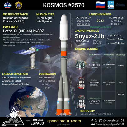
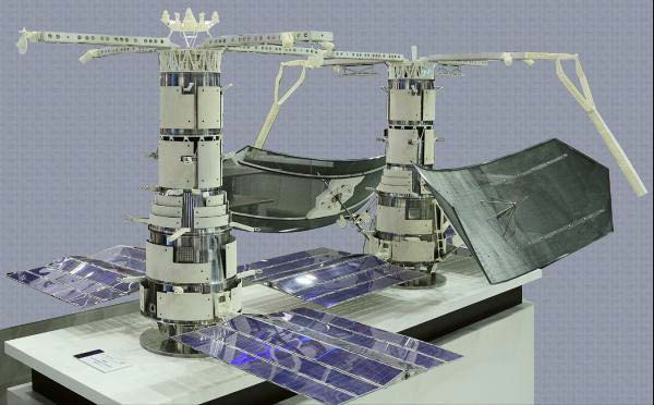
27 Oct 2023: A Soyuz-2-1b rocket lifted off from Plesetsk, likely carrying a classified payload known as Lotos-S1 no. 7 or 14F145, and a secondary payload. It is the eighth addition to the Liana constellation , performing electronic intelligence from space for the Russian armed forces. The satellite, now labeled…
27 Oct 2023: A Soyuz-2-1b rocket lifted off from Plesetsk, likely carrying a classified payload known as Lotos-S1 no. 7 or 14F145, and a secondary payload. It is the eighth addition to the Liana constellation, performing electronic intelligence from space for the Russian armed forces. The satellite, now labeled Kosmos-2570, deployed a small subsatellite (Kosmos-2571), after circularizing its orbit. Launch Video.
– Lotos-S1 No. 7 was initially cataloged in a 240 x 900 km orbit, inclined 67.1°. This is consistent with other Lotos-S1 satellite transfer orbits.
– All of the Lotos-S satellites are in a ~900 km circular orbit and inclined at 67.1°.
– Lotos-S1 No. 7 (Kosmos-2570) joins a network of seven other Lotos satellites, one of which is a developmental version – a Lotos-S spacecraft launched in 2009.
– All eight spacecraft are listed as “active” in publicly- accessible catalogs.
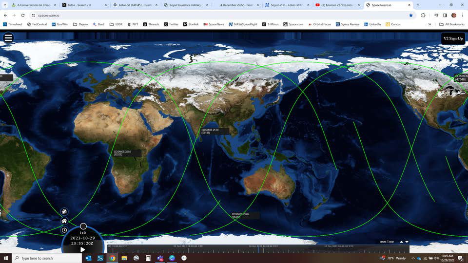
– Other on-line sources note the addition of Kosmos 2570 brings the number of operational satellites to four: 1) Kosmos-2549 (2021); 2) Kosmos-2554 (2022); 3) Kosmos 2565 (2022); and now 4) Kosmos-2570 (2023).
-Kosmos-2570’s initial orbit shows it has opened up a new orbital plane in the Lotos-S constellation. The three earlier satellites are in planes separated by about 120°. Kosmos-2570 has been placed into a plane that is about halfway between that of Kosmos-2554 and 2549.
– As with Kosmos-2565, Russian launch announcement for Kosmos-2570 mentions satellites (plural). The subsatellite release occurred after Kosmos-2570 circularized its orbit on 30 Oct 2023.
– The mission of the sub-satellites (Lotos-S1 No.6 also had one) is unknown. Observers speculate it may be a demonstrator for the possibility of flying an ELINT payload on a small satellite.
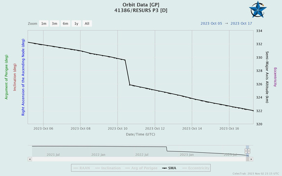
22 Oct 2023: It appears Russia intentionally de-orbited its Resurs-P3 commercial imagery satellite. On 10 Oct 2023, Resurs-P decreased its altitude from 329.6 km to 325.8 km and then proceeded to re-enter the Earth's atmosphere one week later on 17 Oct 2023 (time of last TLE data). Resurs-P3 had been paired with the…
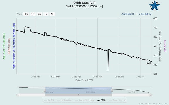
22 Oct 2023: It appears Russia intentionally de-orbited its Resurs-P3 commercial imagery satellite. On 10 Oct 2023, Resurs-P decreased its altitude from 329.6 km to 325.8 km and then proceeded to re-enter the Earth’s atmosphere one week later on 17 Oct 2023 (time of last TLE data). Resurs-P3 had been paired with the experimental Russian satellite, Kosmos-2562 from Oct 2022 – Jul 2023. For its part, Kosmos-2562 remains in orbit but appears to be rapidly decaying.
-In October 2022, Resurs-P3 lowered its altitude to match orbits with Kosmos-2562. The two satellites appear to have conducted multiple rendezvous and proximity operations and separations between Feb 2023 & Jul 2023.
– Resurs-P3 was believed to be non-operational due to problems with the systems needed to downlink imagery, but other on-board systems may still be functional.
– Kosmos-2561 & 2562 were launched on the same vehicle on 22 Oct 2022. Based on launch contracts, there is speculation that both satellites might be part of the Numizmat program.
– Numizmat is a 2014 project started by Russia’s Central Scientific Research Institute of Chemistry and Mechanics (CNIIHM). CNIIHM specializes in small satellites, and their core business seems to be ASAT/inspection missions.
– Known Numizmat payloads are an ultrawide band radar and a TV camera, which could be used for rendezvous and proximity operations.
– With Kosmos-2562 clearly involved in rendezvous and proximity operations with Resurs-P3, it is the fifth type of Russian satellite to engage in that sort of activity in the past decade or so.
– After Kosmos-2562 left the immediate vicinity of Resurs-P3 in July 2023, it has not made any orbit corrections and its orbit is now quickly decaying. It may have run out of propellant after the lengthy rendezvous and proximity operations with Resurs P3.
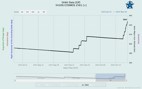
– Notably, Kosmos-2561 has become quite active in the past two weeks, after nearly six months of orbital decay. It has raised its orbit five times since 14 September 2023, increasing its average altitude by more than 36 km.
Resurs-P3 and Kosmos-2562 may have engaged in multiple rendezvous, proximity operations, and separations. Due to the proximity of the satellites and the inaccuracies inherent in TLE measurements, it is difficult to characterize the engagements. From limited publicly available information, it appears only Kosmos-2562 is performing the co-orbital maneuvers.

30 Oct 2023: In an interview with a state-owned Russian-language news channel, the chief of Russian space operations, Yuri Borisov, admitted Russia can only build a few dozen satellites a year. Borisov said building a single satellite in Russia takes about 18 months, and because of this, it is not possible to develop a…
30 Oct 2023: In an interview with a state-owned Russian-language news channel, the chief of Russian space operations, Yuri Borisov, admitted Russia can only build a few dozen satellites a year. Borisov said building a single satellite in Russia takes about 18 months, and because of this, it is not possible to develop a megaconstellation.
– Russia is developing a 264-satellite constellation called “Sphere” that will provide Internet and Earth observation capabilities over Russia.
-According to Borisov, the combined efforts of the US industry and government can build about 3,000 satellites a year, and China has production facilities capable of manufacturing 1,200 to 1,500 satellites a year. The sprawling Russian space corporation he runs, Roscosmos, cannot come close to matching these totals.
– Per Borisov: “It turned out we weren’t ready for this… Today all satellite manufacturing companies of the industry are capable of building about 40 satellites per year.”
– Further, Borisov said Russia currently builds its satellites is by hand, through intricate and time-consuming processes. To become more competitive and have a constellation of its own, he noted Roscosmos will need to move toward an assembly line-like means of mass production.
– Russian President Vladimir Putin stated this is a priority for him. Last week, Putin demanded that Roscosmos “radically reduce” the cost of satellite production and move away from building spacecraft in serial to parallel manufacturing. The Russian head of state ordered an implementation plan be in place by 1 July 2024.
-In spite of massive government funding over the past decade, Russia’s space program has continued to sputter.
-A state media report in Dec 2021 noted that Russia’s space program has a shortage of competent and highly qualified staff, obsolete facilities and technology, and “systemic leadership weakness.”
-From 2019-2021, Russia initiated over 60 criminal investigations, with total losses assessed at more than 5 billion Rubles (US $67.7 million).
-Having taken control of Roscosmos from Dmitry Rogozin in July 2022, it remains to be seen if Borisov will reign in the corruption and nepotism which has hobbled Russian space efforts.




2 Nov 2023: NASA reported Kosmos-2143, a Strela-3 “store and dump” communications satellite disintegrated on orbit on 29 Jun 2023. The event generated six trackable fragments in addition to the original vehicle. The debris is in the vicinity of Kosmos-2143's original 1,416 x 1,398 km orbit with an 82.6° inclination. -…
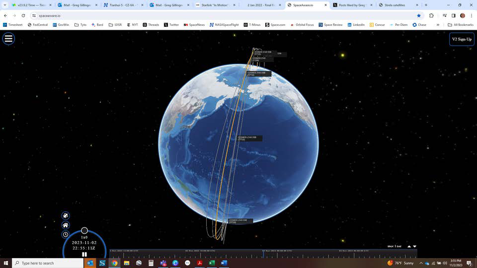
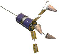
2 Nov 2023: NASA reported Kosmos-2143, a Strela-3 “store and dump” communications satellite disintegrated on orbit on 29 Jun 2023. The event generated six trackable fragments in addition to the original vehicle. The debris is in the vicinity of Kosmos-2143’s original 1,416 x 1,398 km orbit with an 82.6° inclination.
– Russia launched Kosmos-2143 on 16 May 1991, on a Tsyklon-3 rocket under public designation Kosmos-2143, along with five other Strela-3 payloads weighing around 225 kg each.
-According to NASA, there was a similar event within the Strela-3 family on 22 Nov 1985, when Kosmos-1695, disintegrated in orbit after only 43 days.
-A joint US-Russian investigation suspected an NiH2 battery, operating aboard the satellite under 100 atmospheres of pressure, as the source of the blast.
-Interestingly it was another Strela satellite (a defunct Strela-2M) that collided with a US Iridium communications spacecraft on 10 Feb 2009. That was the first instance in the history of space exploration, when two satellites have collided in space. This was most severe accidental fragmentation on record, resulting in more than 1,800 debris pieces ~10 cm and larger.
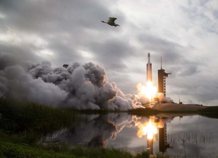
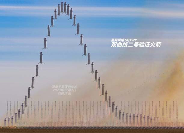
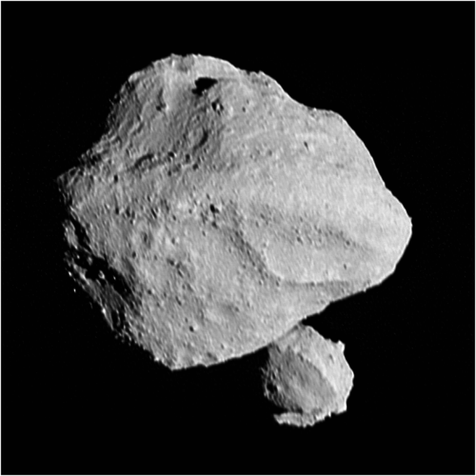
Space imagery and photographs featured in Issue 84.





Flash Insider
Subscribe to unlock full access to this Issue and the complete Flash archive.
Subscribe Now Already Subscribed? Log In