Issue 95

China: SY-12 01 & 02 Conduct 4 “Fly-By” Operations

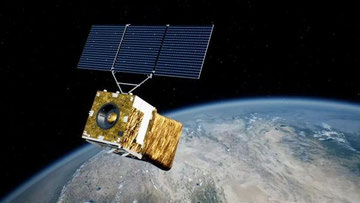
17 Apr 2024: On 23 Dec 2021 (another Christmas present) China launched a LM-7A from Wenchang containing two experimental satellites, Shiyan-12 01 and Shiyan-12 02. After launch China described the purpose of the Shiyan 12 satellites as spatial environment detection and testing. There has been open source comparison…

17 Apr 2024: On 23 Dec 2021 (another Christmas present) China launched a LM-7A from Wenchang containing two experimental satellites, Shiyan-12 01 and Shiyan-12 02. After launch China described the purpose of the Shiyan 12 satellites as spatial environment detection and testing. There has been open source comparison with the US GSSAP mission. There was even some interesting interactions between USA270 and both satellites in 2022 (watch Video). Over the past 2+ both satellites have maneuvered along the GEO belt covering ~17°E – 178°E. The satellites travel in opposite directions and operate independently. Observers (notably the Palski Report) have noted occasional close (but always safe) encounters between the SY-12 satellites and other satellites they encounter during their travels. Thanks to the help of LSAS (Robin!) we were able to take a closer look at 4 of these recent encounters, specifically looking at the Solar Phase Angle (SPA) and whether China may have optimized the SY-12’s for optical imaging operations. Our results were largely inconclusive given our data limitations.

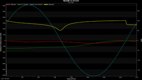
– On 11 Apr 2024 SY-12 01 orbited in proximity of two dead communication satellites in GEO:

1) TELCOM 1; and 2) INTELSAT 29E.

  • TELKOM 1
    • Point of Closest Approach: 50.291123km on 11 Apr 2024 at 22:02:15.424.
    • Taking into account the uncertainty of the position of the satellites location as determined by ground-based sensors the minimum separation between SY-12 01 and TELKOM 1 was 28.745504km at the time of closest approach (TCA).
  • INTELSAT 29E
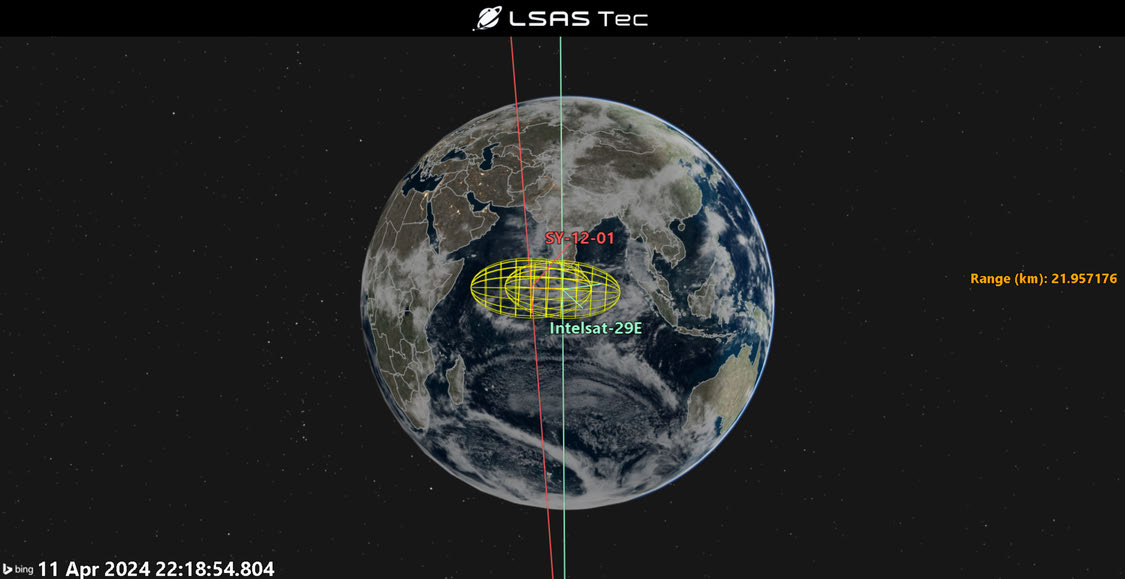
    • Point of Closest Approach: 21.957069km on 11 Apr 2024 at 22:18:54.804
    • Taking into account the uncertainty of the position of the satellites location as determined by ground-based sensors the minimum separation between SY-12 01 and INTELSAT 29E was 9.656713km at TCA.

– The interactions were performed safely and posed no significant risk of collision.

– SJ-12 02 also had 2 recent encounters, but these were with active communications satellites in GEO:

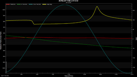
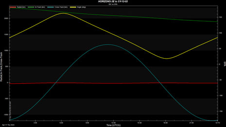
1) EUTELSAT 172B; and 2) HORIZONS 3E

  • EUTELSAT 172B
    • Point of Closest Approach: 54.877388km on 11 Apr 2024 at 05:14:26.659
    • Taking into account the uncertainty of the position of the satellites location as determined by ground-based sensors the minimum separation between SY-12 02 and EUTELSAT 172B was 43.826547km at TCA.
  • HORIZONS 3E
    • Point of Closest Approach: 79.823102km on 16 Apr 2024 on 05:13:22.123.
    • Taking into account the uncertainty of the position of the satellites location as determined by ground-based sensors the minimum separation between SY-12 02 and HORIZONS 3E was 52.731633km at TCA.

– The interactions were performed safely and posed no significant risk of collision.

– China has not revealed any specifics regarding the mission or capabilities of the SY-12 satellites. If the satellites are collecting optical imagery the relative position of the Sun to the imager and target is critical. With this in mind we (Robin) examined the Solar Phase Angle (SPA) at time of closest approach.

– SPA is the angle between vectors of the target to Sun and target to imager. If the angle is close to 180°, then the Sun would be facing the imager and behind the target, rendering the image capture close to impossible, while the lower the angle is, the better the illumination conditions are for the observer.

– SY-12 01 SPA to TELCOM-1 was 93.85° at TCA

– SY-12 01 SPA to INTELSAT-29A was 153.95° at TCA

– SY-12 02 SPA to EUTELSAT 1721B was 83.44° at TCA

– SY-12 02 SPA to Horizons 3E was 117.17° at TCA

With our limited information we cannot confirm the SY-12

satellites are collecting imagery of other satellites. We can

absolutely say that during these close approaches there

were direct lighting conditions on all satellites, with no

umbra or penumbra making imaging a possibility. We did not detect any maneuvers leading up to or during TCA. What we have is a series of “close” approaches which could be sufficient enough for imaging. (Thanks again to Robin and Jason for their assistance!)

Shiyan-12 01 and Shiyan-12 02 patrol opposite directions across the GEO belt between approximately 17°E and 178°E.

Two-year longitude history of Shiyan-12 01 (celestrak.org).

Two-year longitude history of Shiyan-12 02, forming a near mirror image of Shiyan-12 01 (celestrak.org).

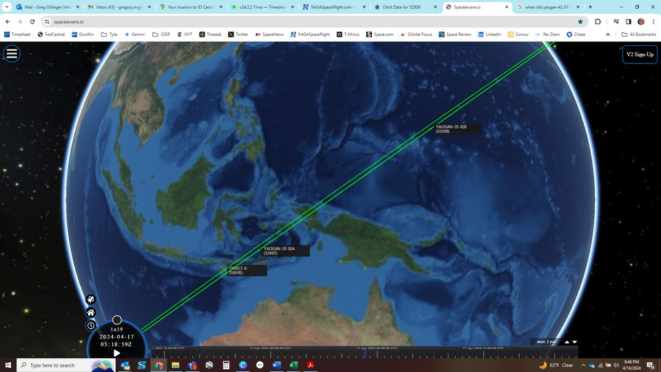
Orbital geometry for the Shiyan-12 01 encounter with Intelsat 29E.

Shiyan-12 01 and Telkom-1 point of closest approach of approximately 50 km, with a solar phase angle of 93.85°.

Shiyan-12 01 and Intelsat 29E point of closest approach of approximately 22 km, with a solar phase angle of 153.95°.

Shiyan-12 02 and Eutelsat 172B point of closest approach of approximately 55 km, with a solar phase angle of 83.44°.

Shiyan-12 02 and Horizons 3E point of closest approach of approximately 80 km, with a solar phase angle of 117.17°.