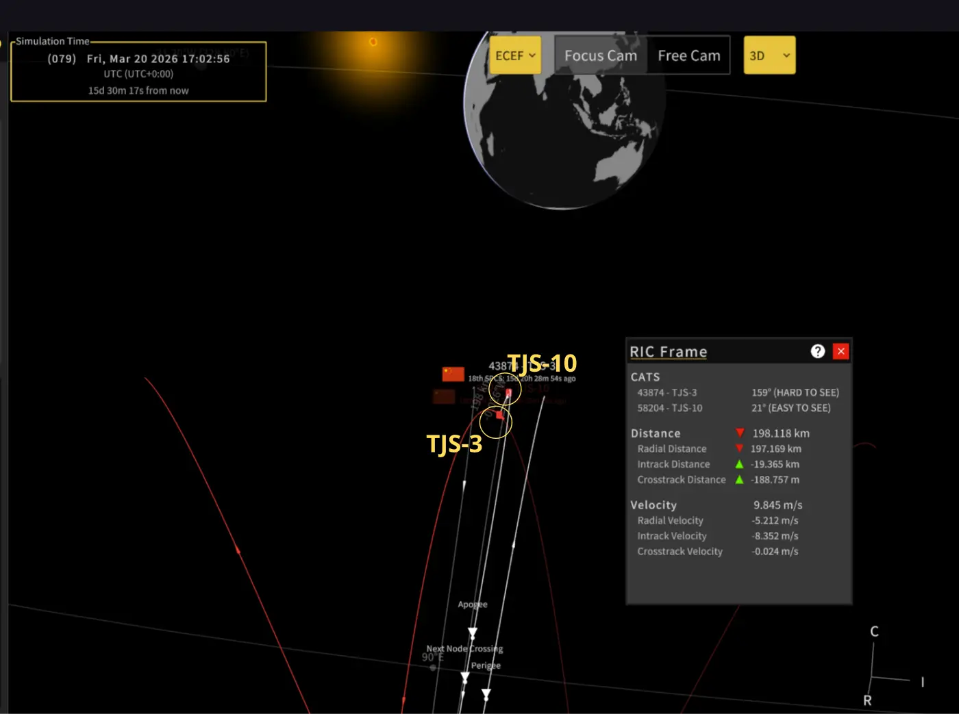
5 Mar 2026: As noted in the last edition of the Flash, Chinese space operators maneuvered both TJS-10 (58204) and TJS-3 (43874) in early February resulting in the two satellites heading toward one another. TJS-10 (58204) remains above the GEO belt and maintains a 1.9°/day westward drift. For its part, TJS-3 increased its SMA 81km on 27 Feb, slowing its eastward drift from ~1.3°/day to 0.2°/day. In their current orbits (as of 5 Mar) TJS-10 and TJS-3 are on course to have a point of closest approach on 20 Mar 2026 at ~1630Z over ~90.4°E longitude.
Recall that TJS-3 and TJS-10 operated in vicinity of one another during TJS-10’s first year on orbit from Nov 2023 – Nov 2024. It appears China purposefully launched TJS-10 into a co-planar orbit with TJS-3 (TJS-3 also conducted minor plane change maneuvers prior to TJS-10 launch). Comparing their current orbital parameters TJS-10 and TJS-3 remain nearly co-planar. Their inclination values are separated by only 0.001° and RAAN by 0.019°.
TJS-3’s most recent maneuver not only slowed its eastward drift, but also changed TJS-3’s eccentricity (orbit shape) to more closely match that of TJS-10. Prior to the maneuver TJS-3’s orbit had an eccentricity of 0.00006; post maneuver the eccentricity was 0.00169. TJS-10’s eccentricity is 0.00111. China has not aligned the Argument of Perigee for the two satellites, TJS-3 Arg of Perigee is 345.1° and TJS-10 is 234.0°. Looking at the two satellites at point of closest approach (assumes no further maneuvers) TJS-3 and TJS-10 will be separated by <1km in cross-track and in-track and just under 200km in radial-track.
Given the past history of these two satellites I anticipate TJS-10 will decrease its SMA prior to crossing paths with TJS-3 and position itself just to the east of TJS-3. In 2024 this distance ranged from 60-200km. We will be able to observe future maneuvers from both satellites…stay tuned!
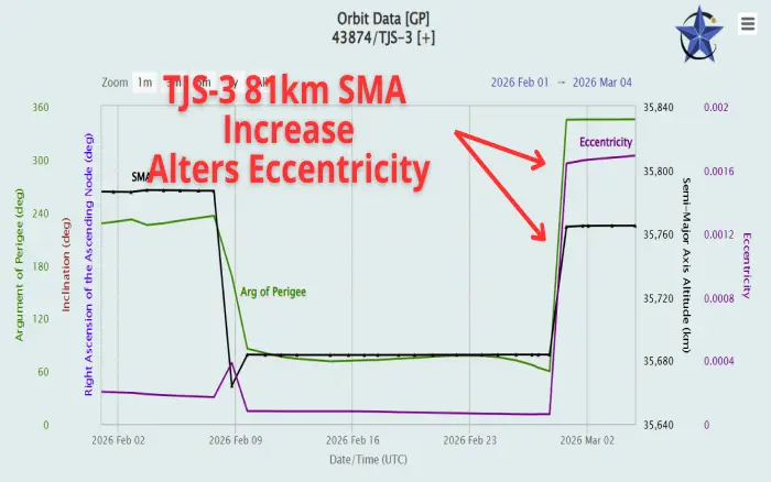
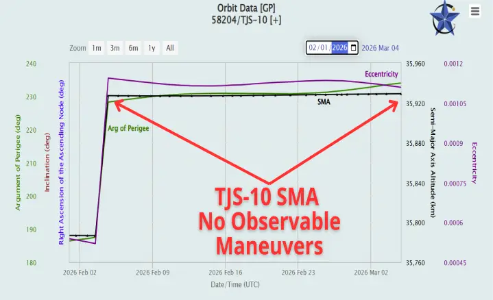
1 Feb – 5 Mar Orbital History of TJS-10 (Left) and TJS-3 (Right)
TJS-10 Holding Steady after 3-4 Feb SMA Increase
TJS-3 Increased SMA 81km 27 Feb 2026 Remains 21km Below GEO
(celestrak.org)
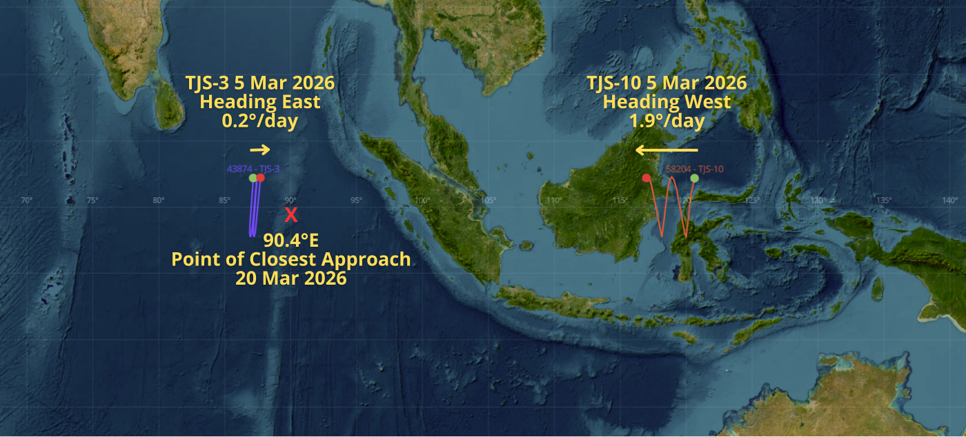
5 Mar: TJS-3 and TJS-10 Current Positions and Point Of Closest Approach Projection
(saberastro.com)