13 May 2026: China maneuvered TJS-3 (43874) into position to observe one of its GEO-based imagery satellites, Gaofen-13 02 (55912). Thank you for the heads up Nathan Parrot! – Chinese space operators decreased TJS-3’s SMA ~121km on 3-5 April 2026, increasing TJS-3’s eastward drift rate from 0.252°/day to 1.8°/day. From early-April through early-May, TJS-3 transited from 95.5°E to 148.2°E. From 4-6 May, Chinese space operators increased TJS-3’s SMA 136.1km to place the satellite within 1km of GEO (35,786km). The maneuvers placed TJS-3 in the vicinity of Gaofen-13 02 at 148.2°E.
For its part, Gaofen-13 02 has not deviated from its pattern of life and has conducted station-keeping maneuvers every 1-1.5 months and is maintaining its location at 148.2°E.
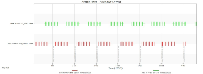
TJS-3 and Gaofen-13 02 are not plane-matched with differing inclination and RAAN values. As a result, the two satellites briefly cross paths every 12 hours. In their current orbits, the two satellites’ time of closest approach is ~0530Z and ~1730Z. During the evening, the satellites are within <20km of one another, with lighting conditions (sun angle) favoring GF-13 02 observing TJS-3 (the sun is behind GF-13 02 and in the face of TJS-3). During the morning pass, there is <75km separation with lighting conditions favoring TJS-3 to observe GF-13 02. (see graphics)
TJS-3’s proximity to GF-13 02 is most certainly purposeful. TJS-3 likely has satellite inspection capabilities and has been noted in the vicinity of other satellites and frequently changes its location. While GF-13 02 has continued to maintain its orbit, the arrival of TJS-3 may signal an anomaly with the satellite. Inspecting the satellite may assist Chinese troubleshooting efforts. We can also not rule out that there may be an issue with TJS-3, and China maneuvered the satellite to take advantage of GF-13 02 imaging capabilities. I suspect this is unlikely, GF-13 02 is used for collecting 15-20m resolution of the Earth, and likely not optimized for satellite-to-satellite imaging. If there is a problem with TJS-3, China would more likely use one of its other GEO test satellites (SJ-17, SJ-21, SJ-23, SJ-25, or SY-12 01/02) to support. Finally, both satellites may be operating nominally, and TJS-3’s relocation is in support of Chinese training and tactics development.

1-3 Apr 2026: TJS-3 Located at 95.5deg E & GF-13 02 at 148.2deg E
(saberastro.com)
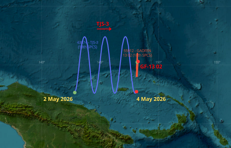
2-4 May 2026: TJS-3 Arrives at GF-13 02’s Position at 148.2deg E
(saberastro.com)
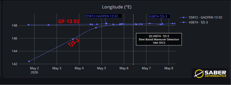
2-8 May 2026: TJS-3 Arrives at GF-13 02’s Position at 148.2°E
(saberastro.com)
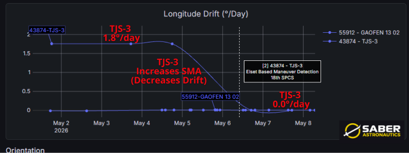
2-8 May 2026: TJS-3 Raises SMA 136km & Stops Eastward Drift
(saberastro.com)
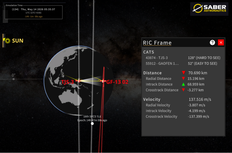
Morning View (0530Z): TJS-3 Favorable Lighting Conditions for Observing GF-13 02 Range: <75km
(saberastro.com)
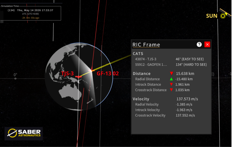
Evening View (1730Z): GF-13 02 Favorable Lighting Conditions for
Observing TJS-3 Range: <20km
(celestrak.org)